HOUSTON – Cardinal Systems announced this week it will be demonstrating its VrLiDAR mapping software at the SPAR International conference here March 21 through 24. According to a press release VrLiDAR’s vector collection methods have been characterized by Cardinal clients as “revolutionary” and a “game changer” in today’s marketplace. VrLiDAR offers a solution to problems faced by mapping professionals today by integrating the collection of point cloud data with VR Mapping’s photogrammetric mapping software.
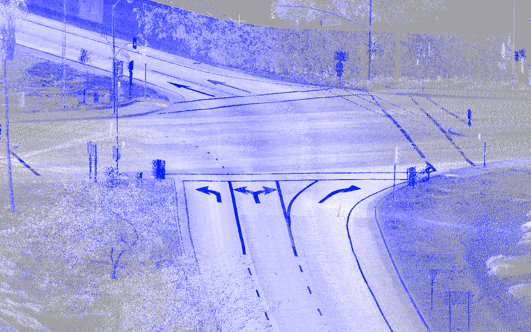
Saying one method of vector collection is no longer adequate, Cardinal emphasized that VrLiDAR provides the user the ability to extract intelligent data from images and/or LiDAR data in the form of vectors and attributes with a choice of four environments: 2D ViewPoint, Photogrammetric Stereo, LiDARgrammetry and 3D ViewPoint. 3DViewPoint displays point cloud data in true three-dimensional stereo and mapping features such as road edges, poles, signs and drainage may be collected on top of this data. The Cursor Draping mode holds the cursor to the LiDAR surface, in the Z axis, as it is moved through the three-dimensional viewing space. The data may be viewed from any angle, origin and scale reducing production times dramatically.
Interested parties are encouraged to stop by Booth #27 for a demo. If you have a specific data set you would like to see, bring an LAS file and a VrLiDAR demo will be personalized to your application.


