Outsight develops real-time 3D lidar perception solutions. The company’s mission is to make lidar-based spatial intelligence "plug and play" ensuring that it is accessible to application developers in every market. Earlier this month, the company released the first real-time lidar solution for the forestry industry. Compatible with any lidar device, the Augmented LiDAR Box (ALB) has pre-processing capabilities to enable smart machines and smart cities to gain an unprecedented level of understanding of their environment.
How it works
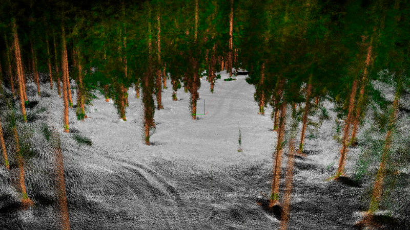
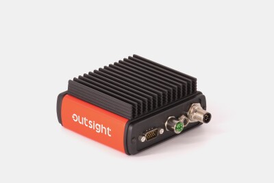
Outsight’s solution, the Augmented LiDAR Box (ALB), is a portable processing unit that features real-time SLAM software and object detection and classification capabilities. A user will need to connect the ALB to a lidar sensor, a tablet, and a battery. It works with a wide range of 360° mobile lidar sensors from a range of brands. There is no need to install any software on the tablet, a web browser connects to the web server embedded in the ALB and displays the super-resolution point cloud of the surroundings in real-time while also providing an easy-to-use user interface. The map, the trees’ IDs, and other characteristics are stored in the ALB during the mapping process and uploaded onto a PC for further post-processing. The output is a *.ply map together with an object list formatted in the proper OSEF data format.
Collecting many tree characteristics
In the first release, only the ground coordinates of the tree (X, Y) are captured. One important feature is the ability for the operator to tag individual trees with supplemental information such as the presence of insects or the species of the tree. This can only be done on-site when the operator can visually inspect the tree displayed on the tablet and log what they observe. Users need to select a tree on the tablet and choose the correct tag from a dropdown list.

The result of this process is an ID, position, and set of tags for each tree on a 3D map. Another essential feature is the storage of a super-resolution 3D map of each tree that is valuable for post-processing software for computing more advanced tree characteristics, such as the diameter at breast height (DBH), at different positions.
Improving the accuracy of airborne forestry monitoring data
This solution further builds upon Outsight’s expertise in the environmental and forestry sectors. In July 2020, Outsight was selected from a large pool of candidates to be a recipient of the European Innovation Council’s inaugural Green Deal funding. A part of the European Union’s Green Deal Strategy, Outsight was chosen for its lidar-based environmental and forestry management and conservation solutions.
Outsight’s solution is already being used by forestry researchers around the world. Esteemed forestry professor, Philippe Nolet, has been using Outsight’s lidar processing technology to assist in his forest monitoring research at Université du Québec en Outaouais in Gatineau, Canada. The solution has also been adopted by Outsight’s Hong Kong-based partner, Insight Robotics, a leader in the Forestry Risk Management sector. Using Outsight’s ground-based lidar tool to supplement its market-leading aerial survey solution, Insight Robotics can provide its clients with even more accurate survey data, allowing customers to better manage their forests and plantations.
Following the success of its forestry-focused lidar solution on three continents, Outsight is continuing to work on new features for this market. There are two main features that Outsight is focused on further developing in the near term: first, Outsight is looking to allow for the real-time processing of advanced tree characteristics like trunk wood volume and trunk shape index. They are also developing a system to fuse data from the LiDAR sensor with camera data to allow for automatic species classification and the automated logging of trees’ visual characteristics.
Outsight's long-standing working relationships with several universities and private companies in the environmental and forestry sectors have been key proving grounds. While airborne forestry monitoring has been popular for some time, the accuracy of the data that is collected has historically been quite poor. Outsight’s terrestrial mapping techniques may enable these (and other) organizations to better calibrate their airborne mapping to significantly improve its accuracy.


