Earlier this month, Autodesk made a series of announcements around updates to products for their customers in the AEC industry. One of the leading software companies for AEC design workflows, their annual product updates are always of interest to those in the industry regarding the new capabilities of products that are used by many in the sector on a daily basis. This year, the company announced updates to ReCap Pro, Civil 3D, and Revit. Overall, the updates cover a number of different specific areas, but generally aim to improve collaboration and efficiency throughout these workflows. Below, find more on the upgrades to the individual products.
ReCap Pro

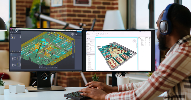
Perhaps of most interest to the Geo Week News readers will be the updates to ReCap Pro, Autodesk’s software solution for creating and working with 3D models created from reality capture data. As Autodesk’s John Sayre recently covered in a webinar hosted on Geo Week News, reality capture is increasingly becoming a core piece of the AEC workflow, particularly for large-scale projects.
Among the updates to the software in ReCap Pro 2026, the most impactful may be the streamlined scan-to-segmented mesh workflow, which the company says should “simplify the process of turning complex 3D scans into actionable BIM elements.”
Traditionally, processing these point clouds requires cloud processing or a powerful local system, but this new update includes local scan-to-mesh capabilities that give users the ability to convert their point clouds into segmented meshes. This, in turn, should reduce the amount of compute power necessary for these workflows and allow the processing to be done locally in an efficient manner.
Additionally, a new Mesh Editor allows for classifying, editing, and exporting lightweight models, which can then be integrated into Revit, again without the traditional barriers around processing large datasets. The new ReCap Mesh Revit plugin allows for a better workflow overall for managing these meshes, a significant development given that some estimates indicate that as much as half of all construction projects in the U.S. are renovations or retrofits, making the collection of this as-built data crucial.
Civil 3D
We know that the demand for infrastructure maintenance and construction is higher than ever before, with assets continuing to age and increases in urbanization leading to the need for new infrastructure around the world. We also know that the firms tasked with completing this work are dealing with workforce shortages, meaning technology is crucial to bridge that gap and keep the work flowing. Civil 3D is Autodesk’s CAD solution for these infrastructure projects.
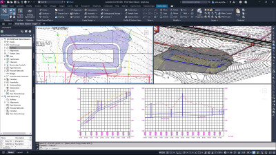
One of the biggest themes around the updates for Civil 3D 2026 is around drainage and being able to analyze models and projects using new integrations. For example, there is a new integration with Dynamo, allowing better workflows for drainage system design of projects. A new node for catchments gives users the ability to automate catchment group management, create catchments from boundary geometry, and configure catchment flow path data effortlessly, while a new FeatureLine.ByPoints node allows for automation in creating basic feature lines across various domains.
These updates also include a new 3D Model Viewer, which allows users to review projects in 3D right within the familiar environment of Civil 3D. We know that 3D visualization allows for better context for these environments and more immediate feedback, so being able to keep this workflow within the same application, and keep it open at all times, the review process can be streamlined.
Revit
Finally, Autodesk also announced updates coming for Revit 2026, enhancing the company’s most used product for the AEC industry. The BIM software has a number of new developments in this latest version, including the aforementioned plugin with ReCap Pro. In addition to that, Autodesk announced an Accelerated Graphics Tech Preview. Using “advanced graphic technologies,” including the Universal Scene Description – Autodesk is a founding member of the Alliance for OpenUSD – they expect this capability to “significantly” improve navigation speed in both 2D and 3D views, even when dealing with large datasets.
In their announcement of updates, they also point toward their desire to automate documentation workflows so, in their words, “users can focus on higher value, creative, and cognitive work.” They’ve added some capabilities for this, including “View to Sheet Positioning and Automated Placement,” automating what is often a tedious task for users, reducitng the need for manual adjustments.
These are just quick overviews of the updates to Autodesk’s AEC products. Find more complete updates by following the links within the sections above.