by Bernhard Richter, Vice President Geomatics, Leica Geosystems (part of Hexagon)
Surveyors have always been resourceful problem solvers, constantly finding new ways to get the job done more efficiently. Still, the rapid pace of technological advancement in recent years has initiated a transition, causing the role of the surveyor to expand significantly, enhancing both productivity and the range of services offered.
Not long ago, it was only possible to capture roughly a thousand data points per day, but now we can capture millions in seconds. Today, surveyors are not only responsible for data collection but also for interpreting this vast amount of data, creating clear visualizations, and streamlining workflows to make complex data accessible to everyone. Machine learning and deep learning are enhancing this process further by reducing tedious, repetitive tasks.
As surveying evolves, there is a growing need for professionals to balance the use of advanced technology with traditional surveying skills. While tools are becoming more accessible and streamlining workflows, they also demand new skill sets that go beyond basic data collection.
Embracing new technology encourages greater productivity and enhanced service offerings. Building expertise ensures resilience. Working smarter — not harder — is critical given the current demand for geospatial services.
New Models for a New Era
Modern surveying technologies are reshaping the industry. Mobile 3D laser scanners and UAVs enable more efficient data collection and change how surveying businesses operate and grow.
Smaller firms are growing into mid-sized companies, which are frequently absorbed into larger geospatial companies, creating a network of diverse departments that include engineering, surveying, environmental services, and more. As they expand, successful organizations are adopting digital tools and cloud platforms to connect surveying data with metainformation. The benefits also extend beyond internal teams, with these same tools enabling seamless collaboration with external partners like architects and local authorities.

Alongside the advancement of technology, the surveying landscape itself is becoming increasingly competitive, with surveyors expanding their skill sets to meet evolving demands. While maintaining that core focus on traditional engineering projects like roads and railways, professionals will increasingly use cutting-edge tools that offer greater efficiency and an expanded scope to augment their services into areas like urban planning, environmental monitoring, and disaster management.
For example, CARRIER Géomètres Experts, a 25-year-old surveying company based in France, was an early adopter of mobile mapping technology, giving them access to a wider range of business opportunities. One unique project they were recently involved in was charting the marathon route at the 2024 Olympics, with the resulting 3D model being used by broadcasters for television replays and 3D placement of advertisements.
This kind of diversification isn’t just about staying relevant; it’s about resilience. By transferring their expertise into different industries, forward-thinking surveyors open doors to new and exciting opportunities.
Evolving technology does not, however, make the job less challenging. As the surveyor's role shifts towards data management, it has, in fact, become more complex. Advanced tools elevate the analytics of clients’ complex data, allowing surveyors to uncover new insights and lower the threshold for expanding into new areas.
The Rapid Rise of Mobile Mapping
A walk through INTERGEO 2024 further highlighted this rapid rise and adoption of mobile mapping and mobile scanning technologies. Although it's not a new technology, the hardware is becoming smaller and lighter, with more advanced camera resolution and real-time processing capabilities.
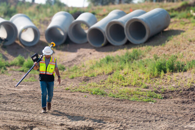
Smaller handheld sensors are becoming easier to use. In addition, AI is moving mobile mapping and scanning technologies beyond traditional data collection to create adaptive mapping solutions. Deep learning is making point cloud classification faster and more accurate. Advanced algorithms can spot errors, identify patterns, and highlight anomalies in spatial data with impressive precision. These systems streamline data processing while keeping privacy in check using anonymization techniques — such as blurring faces and vehicle registration plates at the point of data collection in real-time.
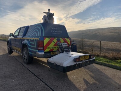
Leading adopters of mobile mapping technologies illustrate the technology's impact. Ben Barnard, Commercial Director at Severn Partnership, a surveying company based in the UK, highlights that “similar to terrestrial laser scanning, mobile mapping offers several advantages, but on a much larger scale. We’re not just reducing the time spent on-site from weeks to a few days — we’re often bringing it down to half a day. Deliverables remain traditional in nature, but with the wealth of data we now have, we can provide simple, straightforward results or complex 3D models.”

The 3D Cadastre Challenge
Today's built environments feature multi-level structures, from underground parking and stairwells to elevated walkways. As cities and megacities become more vertical, there’s an increasing demand for 3D cadastres, which more accurately represent urban spaces.
Some countries and cities — for example, Switzerland, the Netherlands, and Singapore – have already begun pilot projects or partial implementations to incorporate 3D data into their cadastral systems.
Capturing these 3D models has become easier with a wider array of 3D technologies available — such as mobile mapping, mobile scanning and hybrid aerial scanners. This is just one example of the shift from 2D to 3D. All types of surveyors need to think beyond 2D maps and start looking at 3D objects to meet client’s demands.
This shift towards 3D cadastres reflects how advancing technology is allowing for a more accurate depiction of multidimensional urban spaces and also underscores the growing need for surveyors to embrace advanced tools and methodologies. These changes are redefining traditional workflows, requiring surveyors to learn to manage complex 3D datasets in an increasingly data-driven industry.
The Skills Evolution and Adapting to the Next Generation
Surveying has come a long way from its math-heavy roots, evolving into a dynamic, creative field that thrives on the understanding and application of precise geospatial data. Today’s surveyors have more than just technical skills; they excel at adaptive learning, running a business, communication, and teamwork, making the profession more diverse and exciting than ever. Younger professionals want tech-driven, meaningful roles, and the industry is stepping up with exciting tools that attract fresh talent and encourage skill development and retention.
The Surveyor of Tomorrow
Surveyors have a broader array of impactful tasks than ever before: Tackling environmental challenges, ensuring sustainable urban growth, contributing to the reshaping of industries such as construction, and enabling ambitious engineering projects.
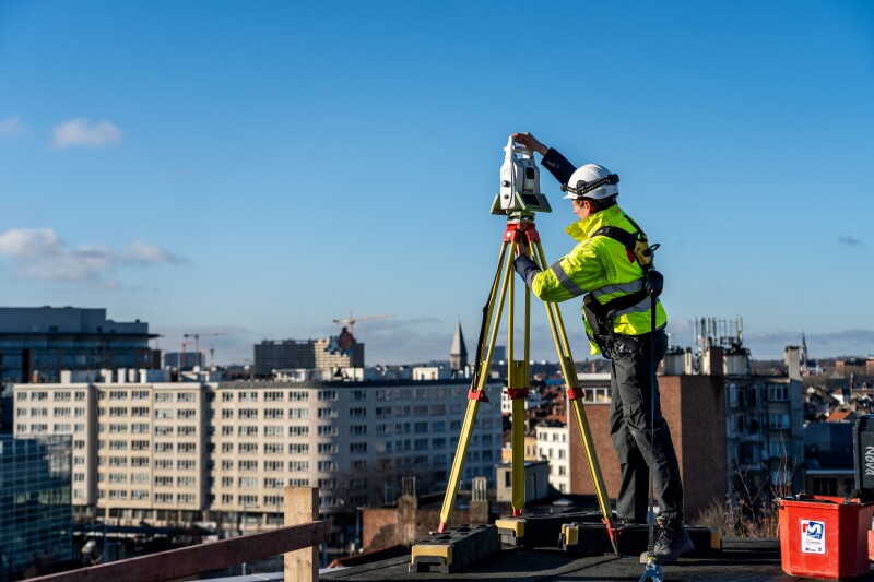
Traditional surveying instruments, such as total stations and GNSS positioning, will always be needed. But surveyors will also continue to see their roles grow as tools like AI, advanced reality capture and data processing unlock new possibilities.
By embracing technological fluency and cultivating a diverse and dynamic skill set, surveyors will continue to leave their mark — on the most significant construction and infrastructure projects of our times and the critical measurements that underpin our cities and landscapes.
As laser scanning technologies become more accessible, we're witnessing a transformation across industries – from maritime sports to law enforcement – where precision, speed, and accuracy are paramount.
 Bernhard Richter completed his studies in Geodesy and Geophysics at the Technical University of Vienna in 1999. He began his career as a research assistant at the Technical University of Graz. In 2005, he earned an MBA from the University of Gloucestershire in England. Since 2000, Bernhard Richter has been working for Leica Geosystems, part of Hexagon, and since 2021, he has been serving as the VP of Geomatics, responsible for product management of total stations, GNSS receivers, surveying software, and RTK correction services.


