

Lidar technology continues to evolve, with manufacturers finding better ways to achieve accuracy, efficiency, and versatility across various industries. In the past few months, several Lidar sensors have been released that are suitable for 3D mapping, aerial survey, or terrestrial mapping.
In this roundup, we will examine some of the latest lidar sensors from industry leaders like RIEGL, Leica Geosystems, Teledyne, FARO, and Z+F, and determine for which applications each is best suited.
Leica Coastal Mapper
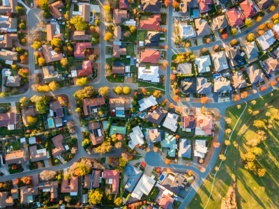
The Leica Coastal Mapper is the latest Bathymetric lidar scanner from Leica Geosystems, part of Hexagon. The company boasts an efficiency increase of up to 250 percent for shallow and deep water surveys compared to traditional workflows. Here are the features that help achieve that efficiency.
- High-performance data capture - The CoastalMapper is equipped with the latest bathymetric lidar module for data collection and TerainMapper3 for topographic mapping. The systems capture data at one million and two million data points, respectively, allowing a GSD of up to five cm.
- Wider field of view—The Leica CoastalMapper has a wider field of view than previous models, such as the Leica Hawkeye 5. This allows it to fly at higher altitudes and cover more ground per flight, improving surveying efficiency.
- Simultaneous data collection - The bathymetric and topographic lidar modules capture data simultaneously, saving time and money.
- Integration with Leica Geosystems’ airborne workflow ensures a seamless workflow and minimizes the time needed to train personnel, especially if they are familiar with Leica Geosystems products.
- Helicopter Mount - In addition to fitting in the same position as other Leica sensors on airplanes, Hexagon is also providing mounts for helicopters. This allows the Leica CoastalMapper to be used in mapping rivers and other rugged terrains.
- Cluster processing - This ensures faster data processing to obtain the necessary deliverables, such as point clouds and DSMs, to quickly analyze and decide the next steps.
What is it best used for?
The CoastalMapper is best suited for coastal and river mapping, flood monitoring, erosion monitoring, environmental studies, and flood risk assessment.
RIEGL VQ-1560 III-S
The RIEGL VQ-1560 III-S is the latest dual-channel laser scanner for airborne mapping. It's currently one of the most versatile airborne mapping systems from REIGL, a leading provider of high-precision lidar systems, and below is why:
- Crossfire scanning pattern - The VQ-1560 III-S utilizes a crossfire scanning pattern designed to minimize shadowing in urban environments and narrow canyons.
- Efficient data collection - This sensor features a repetition rate of up to 4.4 MHz at 1600 M AGL and 560 KHz at 3900 M AGL, allowing detailed mapping at the respective altitudes. It can also cover up to 1130 square kilometers at four points per square meter, allowing it to cover more ground in a single flight.
- IMU/GNSS - The IMU/GNSS integration ensures data accuracy by georeferencing the collected data and correcting any errors.
- Optional RGB NIR integration - You can also add one or two RGB or NIR cameras, allowing users to collect different data types in a single flight.
What is it best used for?
The RIEGL VQ-1560 III-S features make it ideal for high-altitude, wide-area, and high-density mapping, making it suitable for urban planning, national mapping, agriculture, forestry, and infrastructure surveys.
RIEGL VZ-4000i25
Released in late 2024, the RIEGL VZ-4000i25 is an ideal lidar measurement system for long-range terrestrial mapping. With a measurement distance of up to 4600 meters and designed for high-speed capture, this scanner can cover a lot of ground from one location, speeding up the data collection process in varying weather conditions.
RIEGL has done their best to make data collection with their devices seamless, which is evident with the RIEGL VZ-4000i25. You get one-touch control, pre-installed RIEGL apps, and RIEGL's dedicated software, such as the RiSCAn Pro and RiPANO, with pre-installed plugins and the ability to add more plugins and customize the workflow for your needs.
Thanks to the onboard processing and WiFi, data can be quickly collected, processed, and downloaded. This scanner also comes with an IMU/GNSS unit for automatic georeferencing, and users can also add an RTK receiver for more accuracy.
What is it best used for?
The RIEGL VZ-4000i25 excels in long-range terrestrial surveys, including mining, topographic mapping, cultural and natural heritage documentation, and landslide monitoring.
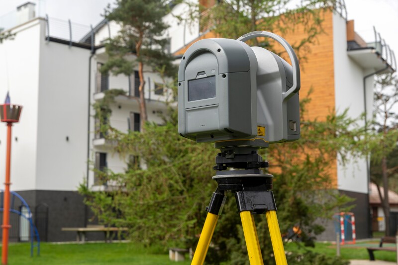
FARO Focus Premium Max
FARO has a new solution for scanning outdoor structures: the Focus Premium Max. This TLS is designed for measuring, 3D model generation, and volumetric calculations in outdoor environments.
The Focus Premium Max promises to cut scanning time by up to 50 percent thanks to the Hybrid Reality Capture enabled by the Flash Technology Solution. With this feature, users can attach a panoramic camera and utilize the Flash Technology, reducing scanning time to one minute per scan. The outputs generated from these scans also feature great detail thanks to the 266-megapixel resolution.
FARO also has its own software ecosystem, which can be used for a streamlined workflow. You can use the FARO Stream App to quickly visualize the data you just collected and ensure there are no errors. The FARO SCENE app is the company’s dedicated app for quick processing, while the FARO Sphere XG streamlines data sharing, management, and team collaboration.
The app and onboard UI allow you to access the Focus Premium Max’s settings, choose the outputs you want, and even add annotations. Onboard WiFi and wireless workflow make controlling this scanner even more seamless.
What is it best used for?
In addition to the features highlighted above, the FOCUS Premium Max is IP54-rated, making it suitable for outdoor use in infrastructure surveying and documentation, forensic analysis, and historic preservation.
Teledyne Fathom
If you are looking for a cost-effective, holistic approach to data capture for coastal areas, the Teledyne Fathom is worth checking out. First launched at the GeoWeek 2025 conference, the Fathom comes with three sensors: topographic lidar, bathymetric lidar, and a 120-Mega Pixel Multispectral camera (RGB and NIR).
This scanner allows you to capture different types of data on the water surface, underwater, and along the shores. Designed for a two-man team and smaller aircraft, it also reduces operational costs.
To ensure a seamless workflow, Teledyne offers Fathom Onboard for processing the data and Fathom Flow for post-processing and creating detailed deliverables. Fathom Flow, powered by CARIS, features automated workflows and quick output formats for fast data processing, allowing users to conduct quality control right in the field and minimize errors.
What is it best used for?
The Teledyne Fathom is best suited for coastal hydrographic mapping, seabed classification, and flood risk assessment. Land surveyors, hydrographers, and photogrammetrists working in coastal areas can benefit from Fathom's accuracy, real-time processing, and cost-effectiveness.
Z+F IMAGER 5024 Supreme
The latest TLS from Z+F is the Imager 5024 Supreme. Released in late 2024, it is designed to improve scanning speeds, range, and accuracy compared to previous models, as well as the Advanced and Essential that were released alongside it.
With a rotation speed of up to 2.2 million pixels per second and a range of up to 365 meters, the Imager Supreme can scan in less than a minute while ensuring accuracy thanks to the inbuilt HDR camera. This scanner is compatible with two cameras: the wide-angle Z+F TopCam camera for increased scanning efficiency and the i-Cam for parallel imaging.
Users can choose one based on the type of data you want.
The Imager 5024 Supreme also has six resolution levels and five quality movies, making it applicable for different use cases.
The Z+F IMAGER 5024 Supreme is also compatible with the Z+F Flexscan, a mobile data collection tool that enhances efficiency and accuracy by combining mobile data with static scan data.
What is it best used for?
The Z+F Imager 5024 Supreme is ideal for infrastructure design and documentation in architecture and construction. The high-quality camera options can also help create accurate 3D models for BIM integration or historical preservation.
What’s Next in Lidar?
Better sensors, faster data collection and processing thanks to cloud computing, sustainable data collection through airborne methods, multiplatform sensors, and the ability to combine data from different sources are some of the trends we can see from the recently released sensors.
For end users, this means faster turn-around times, more accurate data, and reduced operational costs, especially when they can collect different types of data simultaneously. On-board and real-time processing allows quick data-driven decision-making and risk assessment, allowing more efficient project management and execution.
In the future, we can expect to see more of this and the integration of AI to simplify complex data, process large volumes of data, identify patterns, and even create prediction models. This could reduce the turn-around times even further and increase accessibility to more end users, ensuring more industries get reliable geospatial data to guide their decision-making.