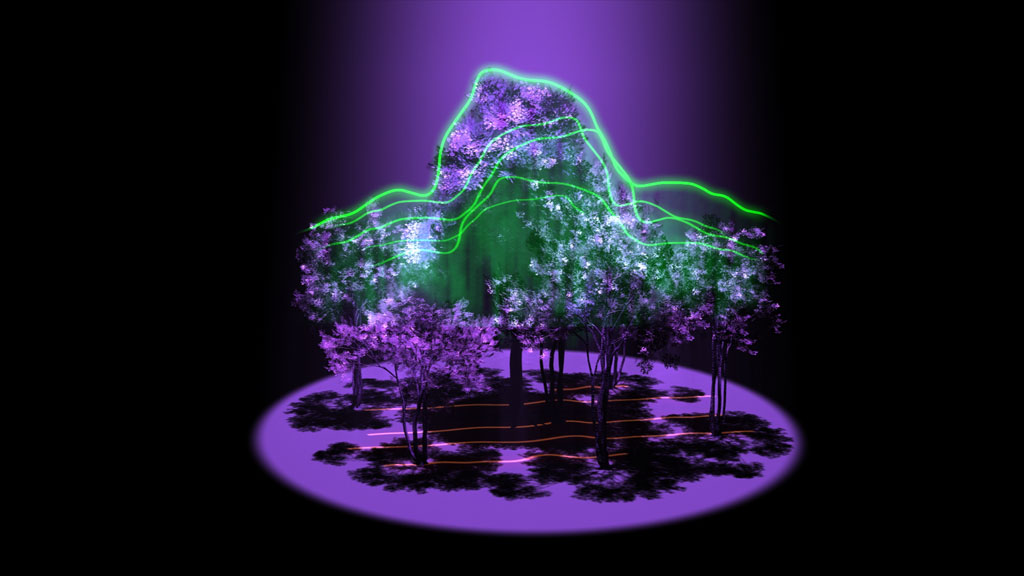
NASA sure loves sending LiDAR sensors up into Earth’s orbit. Their latest spaceborne sensor, (yes, “spaceborne”) which will be loaded onto the International Space Station, is the Global Ecosystem Dynamics Investigation (GEDI) LiDAR. The GEDI, which NASA touts as the first instrument to “systematically probe the depths of the forest from space” will gather 3D measurements of Earth’s forests to give scientists “critical data needed to mitigate the effects of climate change.”
What exactly can a LiDAR sensor in space help us understand about Earth’s forests? “By revealing the 3-D architecture of forests in unprecedented detail,” the press release says, “GEDI will provide crucial information about the impact that trees have on the amount of carbon in the atmosphere. Although it is well-established that trees absorb carbon and store it long-term, scientists have not quantified exactly how much carbon forests contain. As a result, it’s not possible to determine how much carbon would be released if a forest were destroyed, nor how well emissions could be countered by planting new trees.”
Or, more to the point: by determining the amount of biomass the trees contain, scientists can calculate how much carbon they are storing. Combining that data with other comprehensive satellite data sets that show human development and deforestation, scientists hope to “address questions about land use, habitat diversity, and climate effects.” Seems a worthy cause, and a pretty big vote of confidence that 3D scanning technologies are capable enough to help us to solve some of our biggest, most complex problems.
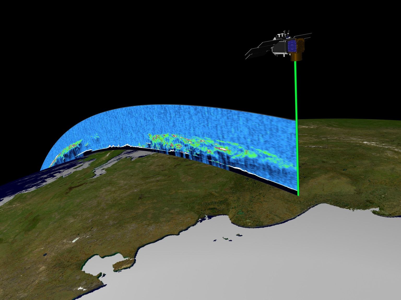 Though I generally try to avoid getting technical, the details of this sensor are too amazing not to share. According to NASA, the GEDI LiDAR includes three lasers developed specially by the Goddard Space Flight Center. Through some kind of optical wizardry, these lasers will be split into 14 tracks that “will be spaced 1,640 feet (500 meters) apart on the surface, creating a total swath width of about 4 miles (6.5 kilometers).” Using this fantastically large scanning swath, NASA will scan “nearly all tropical and temperate forests” on Earth. This is an impressively large data set.
The precision of the sensor also sounds pretty impressive, given that it is firing from an altitude of 205 miles (330 km) above Earth. These lasers can “measure the height of the trees and where the tree canopy begins with an accuracy of 3-1/3 feet (1 meter).” The lasers will send out about 16 million pulses in one year.
It’s pretty remarkable that you use the same technology to measure your buildings and construction sites that NASA uses to gather crucial data on the global climate.
A Brief History of LiDAR at High Altitudes
NASA, of course, is no stranger to the power of a LiDAR sensor for observing Earth from great altitudes. In addition to the LITE project, which saw the first LiDAR sensor sent into space for atmospheric studies, GEDI’s predecessors include the ICESat and LVIS projects. Here’s a quick (and incomplete) primer:
- LITE
In 1994 NASA sent the LITE instrument up with the Space Shuttle Discovery to study other factors related to climate change. (LITE is an acronym within an acronym: LiDAR In-Space Technology Experiment.) Over the course of its nine-day mission, LITE measured the Earth’s cloud cover and tracked various kinds of particles in the atmosphere.
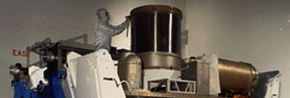
A NASA Langley Scientist prepared LITE for the September 1994 Mission. Source: nasa.gov
On NASA’s fact sheet for LITE, their description of how LiDAR works almost seems quaint in retrospect, though the data they were able to get from it is anything but: “By measuring how much laser light is received by the telescope, scientists can accurately determine the location, distribution and nature of the particles.”
Again, the sheer scale of this project is pretty mind-boggling. First of all, that thing is huge. Second, think about this: the laser began as the size of a pencil at an altitude of 140 nautical miles (260 kilometers), expanding to 984 feet wide (300 meters), or roughly the size of three (American) football fields by the time it hit Earth. The laser was able to measure particles to within 49 feet (15 meters) of their actual location.
- ICESat
In 2003, NASA sent up the ICESat (Ice, Cloud, and land Elevation Satellite) to provide “elevation data needed to determine ice sheet mass balance as well as cloud property information.” The satellite ended its mission in 2009 when the last of its three lasers failed, having gathered a great deal of data and having confirmed the decreasing sizes of the polar ice sheets.
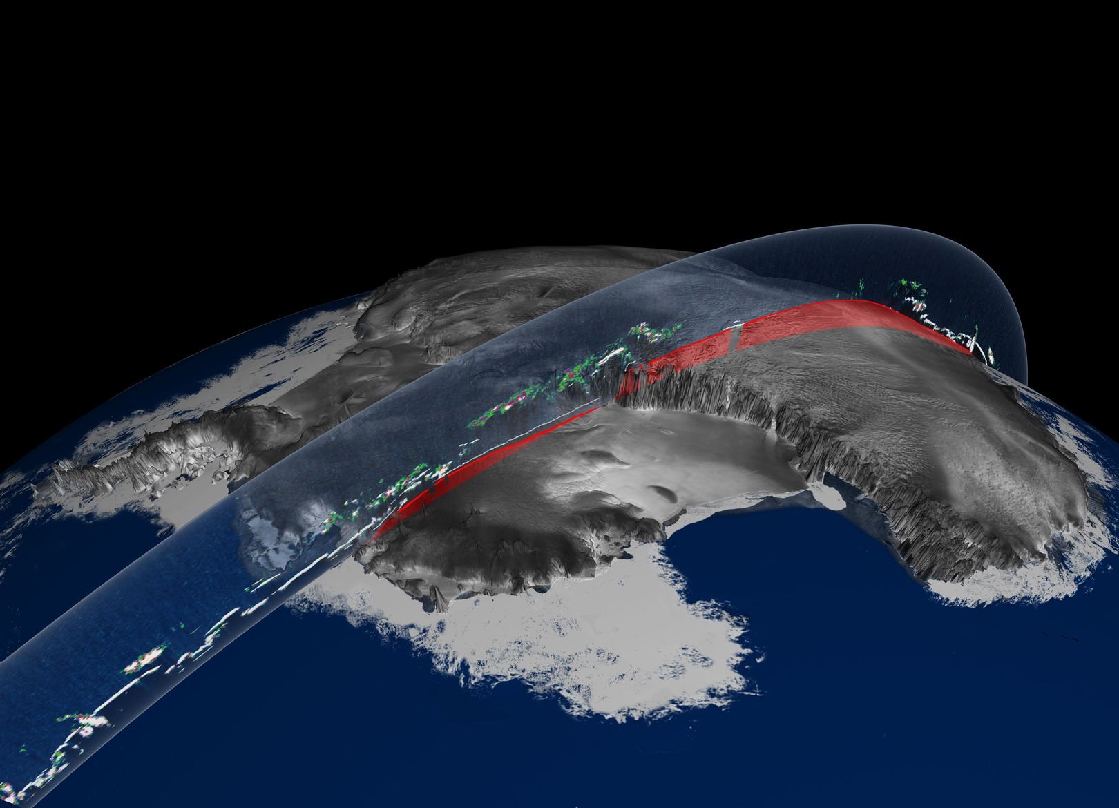
ICESat data swath over Antarctica showing ice sheet elevation and clouds. Source: nasa.gov
- LVIS
The LVIS is an airborne sensor still being used to “measure forests, land topography, ice sheets, glaciers and sea ice.” Check the website for some great images, as well as descriptions of how their instrument works. Maybe you can direct your friends here the next time they ask you to explain how LiDAR works.
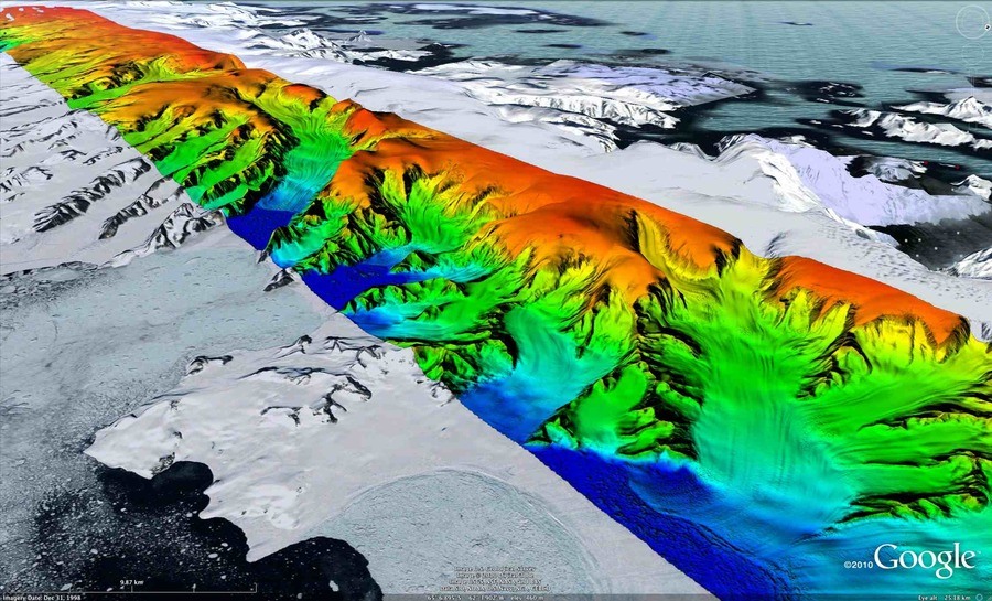
LVIS data over the Antarcic Peninsula draped onto the Google Earth background. Source: nasa.gov
Other Uses of High-Altitude LiDAR
In addition to gathering data on the earth, LiDAR is being used to:
- Size Up Threatening Asteroids
Recently, Optech announced that one of their LiDAR sensors will be sent up to the asteroid Bennu as part of NASA’s OSIRIS-REx mission. (NASA clearly loves their unwieldy acronyms: the project’s name stands for Origins Spectral Interpretation Resource Identification Security Regolith Explorer).
There are some lofty goals for the data NASA hopes to gather with this mission. According to Optech’s press release, “this mission is crucial for determining the exact risk [the asteroid]poses and deciding how to steer it away from our planet if it does come too close. In addition, because Bennu is about 4.5 billion years old, the 3D model and sample returned will help scientists understand the origins of the solar system and the conditions in which Earth and the other planets formed.”
If this mission reminds you of a Hollywood film, you’re not the only one.
- Track the Weather on Mars
Another Optech LiDAR sensor was sent up to Mars as part of a meteorological system designed to track the weather on the planet. By detecting dust, fog, and ice clouds in the lower atmosphere, the sensor both helped scientists to understand Earth’s climate (you may be noticing a theme) and then discovered snow on Mars.
NASA is solving big problems with LiDAR at slightly lower altitudes, too. For instance, the NASA Jet Propulsion Laboratory recently deployed their RIEGL LMS-Q1560 “to more completely and accurately measure snowpack depth major mountain watersheds.” As if that wasn’t enough, see this list of NASA aerial LiDAR projects spanning back to 1991.


