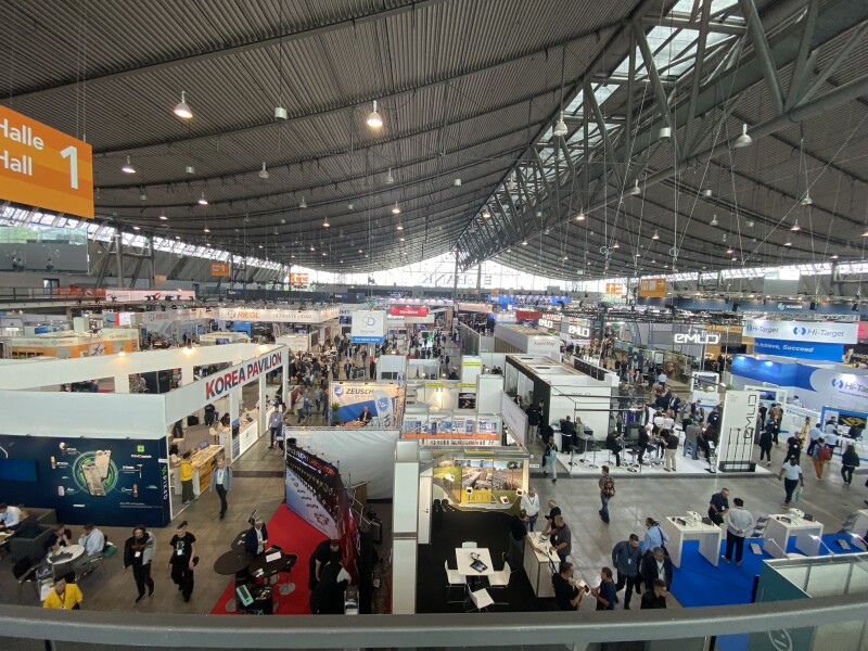
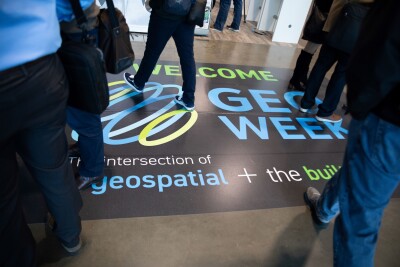
Last week in Stuttgart, Germany, thousands of geospatial professionals from all round the world gathered for the annual Intergeo conference and exhibition. The event featured multiple stages of content covering a variety of topics relevant to geospatial and AEC professionals, as well as three exhibit halls featuring some of the largest companies in the space as well as newcomers looking to bring their ideas and technologies to professionals.
Geo Week News was in attendance for all three days of this year’s event and had a chance to both sit in on some of the conference content put on by organizers as well as walk the floor and speak with executives from the companies who are shaping the next steps for the industry. Below, you can find five broad takeaways from our time in Germany.
Mobile Mapping is Dominating Conversations
Something I was very interested in preparing for this trip to Intergeo was seeing which kind of technology would “dominate” the booths on the floor. My suspicion was that some type of tool or some buzzword would be overwhelmingly obvious as this year’s “theme.” I don’t think it would be fair to suggest that any tool or technology rose to quite that level.
That being said, if I had to choose one technology that seemed to have an outsized representation, mobile mapping would get that nod, and particularly smaller, handheld systems. On the one hand, this is a bit surprising given that it’s not exactly a new technology. On the other hand, it’s a trend that we’ve been seeing throughout the industry over the last year or so as sensors become smaller and more powerful, and professionals are looking for easier sensors to use.
Companies like NavVis, Hexagon, Emesent, and plenty more had their handheld systems on display and people seemed quite interested in learning more. As we’ll get to a bit later in this article, there are conversations to be had about when – and more importantly, when not – to use these tools, but they are clearly here to say and only seem to be improving.
Collaboration and Cooperation are the Paths Forward
Moving away from specific tools and technologies for a moment, the growth around collaboration and cooperation between companies in the industry was apparent throughout this event. Between companies presenting their ideas together on stage to get-togethers hosted by some collaborative initiatives, it was clear that the industry is in many ways coming together. It’s something we’ve highlighted here at Geo Week News around the prevalence of open data and cross-industry collaboration, and it was apparent at this event as well.
Geo Week News spoke with Dr. Kate Fickas, Director of Imagery and Remote Sensing Solutions with Esri, for a separate article, and part of that conversation dove into the importance of this collaboration. Dr. Fickas expressed excitement around this trend, noting that the industry as a whole can only reach its full potential if everyone comes together offering their respective strengths to benefit in areas where they may not have the expertise. A prime example of this is the Overture Maps Foundation, built up of massive companies who are recognizing this trend, and an organization with which Esri is heavily involved.
In addition to that conversation, Geo Week News also had the chance to attend a networking event with the European Association of Aerial Surveying Industries. Marcos Martinez, the organization’s Secretary General, told Geo Week News that the EAASI has been organizing similar events for a few years now and it has steadily grown each year, culminating in a huge turnout for this year’s event. It was a strong display of the geospatial industry’s desire – from both companies and professionals – to work more collaboratively and move away from any arm’s length operations.
Modularity in Tools
Getting back to specific technology, and specifically the idea that no one tool really stood out as a trend, one of the reasons could be that modularity is becoming more realistic for many of data capturing tools. Emesent was among many companies who were showing off modular laser scanners, allowing for end users to purchase one system and be able to use it for a variety of use cases. The show floor included singular tools that could be used as handheld scanners while also easily being transferred to backpacks, vehicles, UAVs, and more.
Simplicity versus Expertise
One of the dominant topics of conversation around any geospatial event today is the battle between growing simplicity around tools and the expertise required to complete surveying projects. It comes as no surprise that these conversations were happening again at Intergeo, as companies again released new tools promising simpler workflows and broad “democratization.”
While it can be a contentious conversation at times from either side of the issue, it is also one that is much-needed in the industry and there needs to be understanding from both sides on what the other side is thinking. In my conversations on this topic, there is a general feeling that the other side of the issue isn’t looking at things from the right perspective.
In reality, the answer is that there are projects that need the extensive training and, frankly, legal viability of a fully trained surveyor, while there are others that can be done with someone who has some experience with laser scanning but may not be fully trained. It will take time, but my sense coming out of this week is that we are approaching that middle ground, even if there are going to be bumps along the way.
Large-Scale Digital Twins
Walking around the floor, one of the other terms that was seen throughout exhibitor’s booths was “digital twin.” This doesn’t come as too much of a surprise given the buzzword quality that “digital twin” has carried for years at this point, but the focus seems to be increasingly on larger-scale digital twins, be it for cities, provinces, or small nations. There are a few reasons this seems to be the case, from the ease of capturing data from both crewed airplanes and satellites, and the proliferation of artificial intelligence to make that massive amount of data useful.
This is a trend that should only continue, and it seems like it’s prime for a big jump in popularity over the next few years. AI doesn’t seem to be going away, and satellite data is improving rapidly and significantly, so now it’s a matter of getting end users to buy in. Given that many of these end users are ultimately governments, buy-in will probably be slower than if it was a private-facing use case, but it’s clear that the companies are ready to show off their capabilities and put the technology into real-world use.


