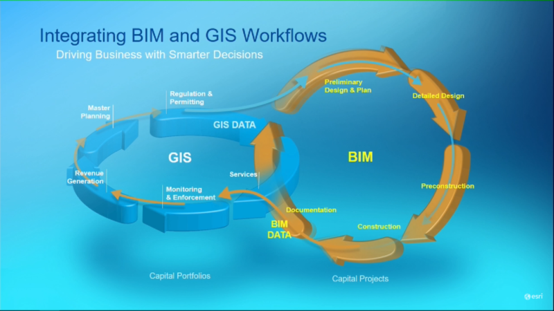
When the Esri/Autodesk partnership was announced, both companies promised to establish more tightly integrated GIS and BIM workflows. They also promised a more seamless exchange, a connection between the spatial and attribute data typically captured in Esri’s GIS systems and the information from 3D BIM models in Autodesk’s design software.
Since announcing the Esri/Autodesk partnership last November, Esri has been working on a future roadmap for BIM-GIS integration with ArcGIS. The company presented this roadmap during the last DevSummit in Palm Springs, last March.
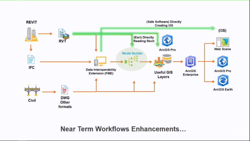
The roadmap for BIM-GIS integration shows how Esri plans to integrate BIM models into its own workflows. The next release of ArcGIS Pro will offer direct reading capabilities for Autodesk Revit so that BIM information can be brought into the ArcGIS platform’s workflows. This capability is planned for ArcGIS Pro 2.2, scheduled for release this summer. Until now, ArcGIS Desktop could only read BIM information using Industry Foundation Classes (IFC) files. It did this through the Interoperability Extension, a plugin for data conversion.

Esri plans to enhance current workflows for the integration of BIM data.
What GIS users can do with BIM data
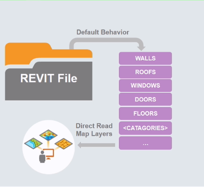
With this new Revit reading capability, GIS users will be able to do two things. One, they can visualize BIM information in ArcGIS Pro, preserving the semantically structured information from Revit through feature classes, which are collections of map features in a GIS. This enables them to use the features they want from the data model for other purposes, such as asset management.
Two, an entire BIM model can now be visualized in a geographic context. This visualization capability will bring some more clarity to GIS users of what´s inside a BIM model. Equally important is what´s not inside a BIM model, for example rooms and spaces—both are geometric entities familiar to the GIS world and used for analysis, but not for architects. Because Revit offers a limited amount of categories, these are all mapped to a feature class that provides access to all associated attribute and parametric information. IFC, in comparison, uses many more categories that are less easy to manage in a GIS.
The way Esri handles Revit data inside ArcGIS is similar to the way it does CAD data, meaning that it abstracts the data and interprets it as a GIS dataset. ArcGIS can export feature classes into .dwg format that can be accessed in AutoCAD using a plugin called ArcGIS for AutoCAD. The Revit read capability is a first step in a similar process for BIM data.

ArcGIS Pro directly gives access to Revit’s data model categories.
Wider plans
On a broader level, Esri is not trying to reinvent BIM, but using BIM data to improve their current 3D platform. Esri has been working hard to make 3D data an integral part of their ArcGIS platform, including desktop, mobile, server and cloud. Esri also announced that it´s working with Safe Software (the company behind the Interoperability Extension in ArcGIS) on direct creation from Revit to I3S data, a new 3D industry standard for exchanging 3D data locally or through the web. Apart from Esri, this OGC standard file format has been adopted by Melown and Bentley Systems. When this feature will be released is not yet clear at this point.


