Every week, we highlight stories from friends around the internet that put a spotlight on the latest from within the geospatial, advanced visualization, and AEC industries. These stories can take many different forms, whether they be about a new innovation or workflow, an interesting and/or unique use case for technology, or a higher-level look at the state of the sector. Today, we have stories about a lidar mapping project in Romania, how digital twins are changing architecture, and a new announcement from Google’s research team.
Find links to the full articles below.
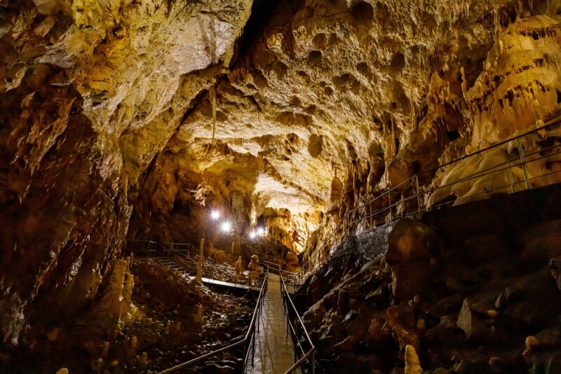
Lidar Cave Mapping in Romania: A 3D Scanning Journey Underground
Lidar News
SLAM technology has changed so much about the way we do surveying, and development in wearable and handheld scanners has allowed more precise mapping of many remote areas. This article highlights one of these use cases, looking at how the NavVis VLX scanner was used to map the Bear Cave in Romania. The article looks at some of the history of laser scanning in the area, and how technology was used in the project.
Digital Twins in Architecture: Future of Building Management
Shradha Pattnaik | Meer
Digital twins are, of course, one of our main areas of coverage in recent years at Geo Week News, as the technology becomes a tangibly valuable tool rather than a theoretical buzzword. Generally, we’re talking about these digital twins in the context of facility management to enhance operations of complex environments, such as ports, or in the context of the base data to create digital twins, such as lidar, satellite imagery, or aerial imagery. This article looks at digital twins from the perspective of architects, looking at how the technology could change the landscape of that sector in the coming years.
Geospatial Reasoning: Unlocking Insights With Generative AI and Multiple Foundation Models
David Schottlander and Tomer Shekel | Google Research
Google has been among the leaders in the development of artificial intelligence tools in recent years. Given that, along with their expertise in the geospatial realm as well as the sheer amount of data they have, it makes sense that they would also be introducing AI-based tools for the industry. They’ve released a few pre-trained models in the past, and this week they announced the release of a new remote sensing foundation model that comes along with a research effort they’re calling Geospatial Reasoning. This article dives into what they’re hoping to accomplish with this, and how it works.