Every week, we highlight stories from friends around the internet that put a spotlight on the latest in the 3D technology industry. These stories can take many different forms, whether they be about a new innovation or workflow, an interesting and/or unique use case for 3D technology, or a higher level look at the state of the sector. Today, we look at the benefits construction professionals can gain from using reality capture, how large-scale digital twins can help climate scientists, and new deep-sea photogrammetry methods.
Find links to the full stories below.
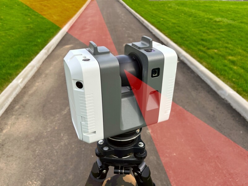
How to Empower Design and Construction Leaders with Reality Capture
Stephanie Lin | Autodesk
Reality capture technology has been making gains in terms of adoption on construction sites for years at this point. Even so, there is still plenty of room for more adoption, and some professionals are still a bit hesitant to add new technology – particularly expensive technology – to their workflows. This article from Autodesk highlights some of the biggest challenges in adopting this technology, and how construction firms can address the barriers.
Can digital twins transport climate science to the future?
Matt Lynes | The Parliament Magazine
Most of the time when we discuss digital twins in this space, we’re talking about smaller scale use cases for individual assets or slightly larger campuses. However, as data collection becomes cheaper and more powerful over larger areas, we’re starting to see more tangible use cases for these large-scale digital twins. In this article, Lynes looks at a digital twin for the entire Earth, and whether or not the EU can – and should – be using these tools, along with artificial intelligence, to help inform climate science.
Underwater Photogrammetry Reaches New Depths
Woods Hole Coastal and Marine Science Center | USGS
This article looks at a recent project undertaken by the United States Geological Survey (USGS) around creating 3D models for the sea floors. A group of researchers from USGS recently published a new study in Journal of Marine Science and Engineering around creating these photogrammetric models using archived video images from the deep seafloor. The article includes a link to that full study, as well as a summarization of the work done by the team of researchers.