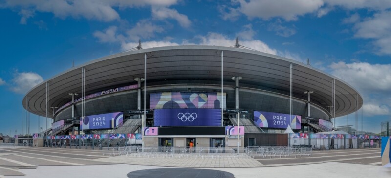
Yesterday marked the conclusion of the 2024 Olympic Games, one of the most memorable editions of the top athletic competition in the world, held this year in Paris, France. Both the Opening and Closing ceremonies created plenty of justified buzz, but of course it was the athletic achievement on display that defined the two-week event. Watching from home in the United States, one of the most pleasantly surprising aspects of this year’s Olympics was the unexpected amount of crossover between these Games and what we cover at Geo Week News around 3D, geospatial, and AEC technologies.
In terms of the actual competition on the field, it was geospatial technologies that were helping separate the competitors with precise measuring capabilities. This is something we had covered in Geo Week News last week thanks to a guest post from Leica Geosystems, part of Hexagon, and Hans-Martin Zogg. In the guest post, he detailed how precise laser scanning systems like the ones provided by Leica Geosystems are being used for measurements in events like the long jump, shot put, discus throw, and more. As he writes, the total stations are stationed on the sidelines of these events and used to measure and record distances accomplished by the athletes in precise manners to determine the winners.
Along with this use of the technology in the actual competition, those of us at home also had our viewing experiences lifted by the use of some new and exciting 3D visualization technologies. For example, Cesium is one of the premier 3D geospatial platforms, and their technology was used to help NBC Sports, who holds the broadcasting rights for the Games in the United States. NBC had the task of displaying quickly and easily to viewers the scope of how Paris was hosting the games and where different events were held, and they opted to use 3D visualizations to fly through the city and show these event locations. To do so, they paired its 3D models of stadiums and venues with Cesium for Unreal and Google’s Photorealistic 3D Tiles, which we covered at Geo Week News here.
Continuing with the theme of coverage and watching the Games, viewers of events like diving, skateboarding, gymnastics, and more got to see a different kind of replay. In these events where athletes are flipping through the air, replays show recreated 3D freeze-frames of the athlete at different points during a jump, somehow showing even more how amazing some of these athletic feats are. It’s not clear the exact technique that was used to make these 3D renderings, but they sure sound similar to NeRFs, applying artificial intelligence to a series of frames from a video. You can learn more about that in this article.
Continuing with the theme for 3D but moving more behind the scenes, digital twins were also used by the organizers of Paris 2024 to visualize and simulate some of the venues, as this post from OnePlan details. OnePlan was the “Official Supporter of GIS Mapping and Digital Twin software” for Paris 2024, and the linked post outlines all of the different areas from this year’s Olympics that took advantage of this digital twin technology, including the swimming venue and the arena used for beach volleyball, right in front of the Eiffel Tower.
With this year’s Olympics now in the books, we look ahead to the next edition of the Summer Games, which will be held in Los Angeles in 2028. And sure enough, we’re already seeing how relevant technology is set to be used for that event. One of the most noteworthy goals for LA28 is their pledge to create all of the event spaces without any new, permanent builds. That means a lot of renovation and repurposing of existing buildings as well as finding sustainable ways to create temporary event spaces. As one would imagine, that process will involve a lot of different stakeholders and moving pieces, which means a lot of data that can be lost in the shuffle. To help with that, as well as with planning technologies like BIM, LA28 has partnered with Autodesk for make and design software.
We generally would not think about geospatial tools being a perfect partner for the premier international athletic competition, but as we’ve seen there was a tremendous amount of overlap this year. Whether it’s laser scanners being used in the actual competitions, 3D visualization techniques being used to enhance broadcasts, or AEC technologies used to streamline planning, these technologies were key to making these Olympic Games move smoothly.